Al Arish Abandoned Village, Al Shamal
A deserted pearling and fishing village with a cracked minaret, an old police station and stone fish traps on Qatar's far north-west coast.
Al Arish, west of Madinat ash Shamal (north-west coast)
Overview
Al Arish is an abandoned fishing and pearling village on the far north-west coast of Qatar, a few kilometres west of Madinat ash Shamal. What you find today is a cluster of roofless stone houses, a ruined mosque whose minaret still stands tall above the flats, an old police station by the water and long stone fish traps in the shallows. Around it lie salt flats, scrubby mangrove bushes and a wide, quiet bay.
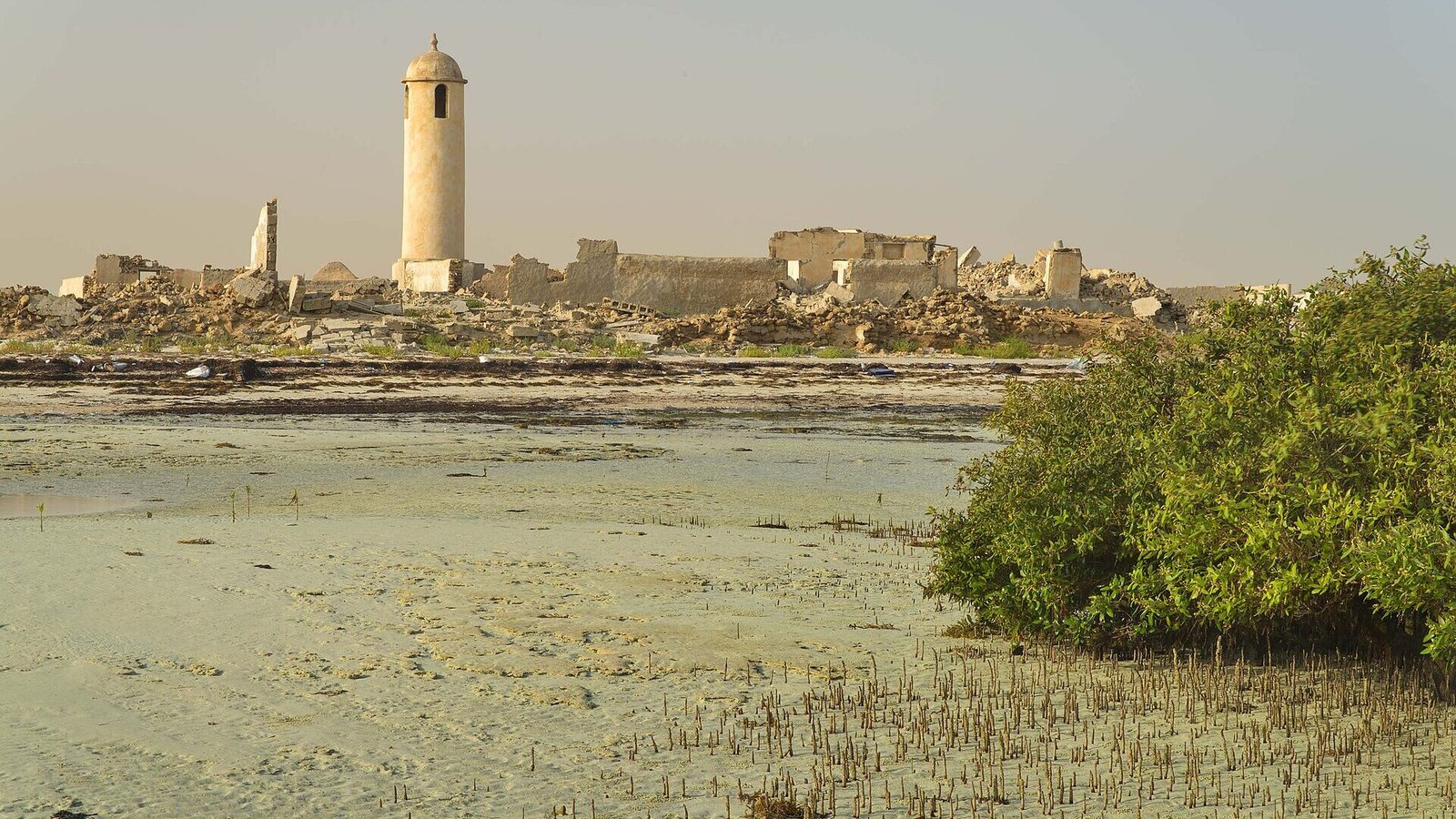
Of all the empty villages along this coast, Al Arish has perhaps the most recognisable silhouette. The cracked minaret, seen across the tidal flats with mangroves in the foreground, is one of the classic images of northern Qatar. Up close the village is fragile and quietly moving: you can still see how rooms were arranged, how roofs were built, and how close to the sea everyone lived.
It suits travellers who enjoy the north’s slower pace: photographers, history-minded explorers, families who want an easy walk with something to discover, and anyone already visiting Al Zubarah or Al Ruwais. It is a place to wander rather than to tour, and it pairs perfectly with the neighbouring ruins of Al Khuwayr just up the coast.
The story behind Al Arish
The name comes from the Arabic arish, usually linked to palm trees and the shelters made from their fronds, which suggests there was once more shade and greenery here than there is today. For generations, life in Al Arish revolved around the sea. Families fished, dived for pearls in season and traded along the coast, and the village grew into one of the larger pre-oil settlements on the northern shore, with around 40 buildings.
Its houses were built the way most coastal homes in Qatar were before concrete: walls of coral rock and limestone bound with mud mortar, thick enough to hold off heat and wind-blown sand. Some roofs used closely packed mangrove branches laid over poles and sealed with more mud. The mosque, with its tall minaret and spiral staircase, was the focal point of the community, alongside a central open square.
The village also appears in the political history of the north. In July 1937, during a dispute over the Zubarah area, forces of Sheikh Abdullah bin Jassim Al Thani occupied several villages on this coast, among them Al Arish.
The decline came with oil. As oil income transformed Qatar from the 1950s onwards, people no longer needed to live from fishing and pearling, and families moved to new homes with electricity, schools and jobs in towns. Al Arish was emptied over the following decades. In 1975 a power station was opened at Al Arish to supply electricity to the growing population of the north, a sign of how the area’s role had changed. Today the old village is recorded by archaeologists as one of a chain of abandoned coastal settlements, with surveys noting its central square, police station and intertidal fish traps.
What to see and do
The minaret
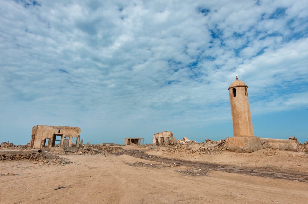
The mosque’s minaret is the best-preserved structure in the village and the reason most people come. It is a slender tower with cracks running through it, and inside an old spiral staircase still winds upwards. Admire it from outside and do not climb it: the structure is damaged and a fall or collapse here would be serious, with no help close by. Around its base you can make out the remains of the mosque’s walls, its ablution area and the line of the outer courtyard.
The central square and houses
Walk slowly through the lanes between the houses. Many still show doorways, wall niches and the outlines of courtyards. Look closely at the walls and you will see the coral rock and limestone they were built with, held together by mud. In a few places traces of the old roofing survive, with mangrove poles laid side by side. The open central square gives you a good sense of how compact and communal the village was.
The old police station
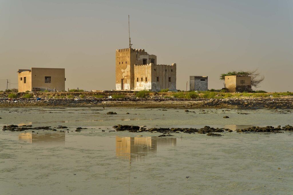
Near the water stands a more modern, boxy building: the old police station. It is a reminder that the village stayed occupied well into the 20th century. At high tide or after rain, the shallow water in front of it can create mirror-like reflections, a favourite photo of this spot.
Stone fish traps
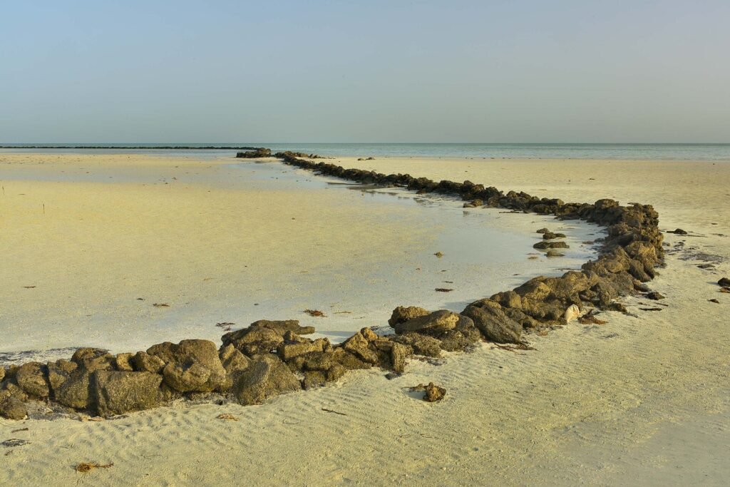
Offshore, long walls of stacked stones bend across the tidal flats. These are traditional fish traps, designed to hold fish behind as the tide falls. At low tide they are fully exposed and you can follow their curves from the shore. Don’t walk on them or move stones; they are part of the heritage record.
The cemetery and the flats
Just outside the village lies an old cemetery with simple, unmarked stones. Treat it with respect: keep your distance, don’t walk across the graves and avoid photographing it as a backdrop. Beyond it, the coastal flats and the Sabkhat Al Arish salt flat stretch away to the south-west, home to waders and other shorebirds in the cooler months.
Photography at golden hour
Al Arish faces the open sea to the north and west, and the late afternoon light turns the stone warm gold. The minaret makes a strong focal point from many angles: across the mangroves, from the square or framed by a ruined doorway. Bring a wide lens for the houses and a short telephoto for compressing the minaret against the sky. Drones require permission in Qatar.
How to get there
From Doha, drive north on the Al Shamal Road towards Madinat ash Shamal. Before you reach the town, turn west towards the coast following signs for Al Arish and Al Khuwayr, or use the map pin on this page, which is set on the village ruins. The drive is around 110 to 120 km and takes about an hour and a half.
The main roads are paved. The final approach to the ruins is on short sandy or gravel tracks across low ground. A normal car can often manage in dry weather if driven carefully, but a 4×4 or SUV is the safer choice, and after rain the flats can become soft and muddy. Park on firm ground at the edge of the village and walk in.
There is no public transport to the village. If you don’t drive, look for private tour operators offering north-west heritage tours that include abandoned villages; some combine Al Zubarah, Al Jumail and Al Arish in one day.
Best time to visit
The best months are November to March, when daytime temperatures are comfortable for walking around an exposed site. In summer the heat and humidity are punishing and there is no shade at all.
Late afternoon is ideal: softer light, cooler air and the chance of a sunset over the sea. If you want to see the fish traps fully exposed, check the tides and aim for low water. Weekdays are very quiet; even at weekends you are unlikely to meet more than a handful of other visitors.
Tips for your visit
- Don’t climb the minaret. The staircase may look tempting, but the structure is cracked and unstable.
- Stay out of fragile buildings. Walls and roofs can collapse. Look in through doorways rather than walking through damaged rooms.
- Respect barriers and signs. Heritage sites in the north are sometimes fenced for protection or restoration work. If you find a fence, view the ruins from outside.
- Leave everything as it is. Don’t remove stones, pottery or roofing material.
- Be respectful at the cemetery and mosque. Dress modestly and keep noise down.
- Bring your own supplies. There are no facilities on site. The nearest shops and fuel are in Madinat ash Shamal and Al Ruwais.
- Watch your footing. Rubble, holes and sharp stone are common underfoot.
What to bring
- Water and snacks
- Hat, sunglasses and sunscreen
- Sturdy closed shoes
- Camera with wide and short telephoto lenses
- Binoculars for shorebirds
- Rubbish bag
Combine it with nearby places
Al Khuwayr Abandoned Village. A few kilometres north-east along the coast, this older settlement was once a base of Rahma bin Jaber and has evocative ruins, including a mosque and wooden structures.
Al Jumail Abandoned Village. Further east towards Al Ruwais, another deserted village with a well-preserved mosque and minaret.
Al Rakiyat Fort. A restored fort a short drive inland, with clean walls and corner towers.
Shadows Travelling on the Sea of the Day. Olafur Eliasson’s mirrored pavilions in the desert to the south, near Al Zubarah.
Freiha Archaeological Site. The remains of an older town and fish traps just north of Al Zubarah.
Frequently asked questions
Where is Al Arish in Qatar?
Al Arish is on the north-west coast in Al Shamal municipality, a few kilometres south-west of Al Khuwayr and roughly 15 km west of Madinat ash Shamal.
Is Al Arish open to visitors?
The ruins are not a staffed attraction and have no opening hours or ticket. Visitors walk around the village, but you should respect any fences, signs or restoration work and avoid entering unstable buildings.
When was Al Arish abandoned?
The village was emptied gradually after oil wealth changed Qatar’s economy from the 1950s; accounts say people were still living there into the 1970s.
Can I climb the minaret?
No. The staircase is still in place but the tower is cracked and unsafe. Admire it from outside.
Do I need a 4×4?
A careful driver can often reach the edge of the ruins in a normal car in dry weather, but a 4×4 or SUV is recommended, especially after rain.
Is there anything to eat nearby?
Not at the site. Madinat ash Shamal and Al Ruwais have small shops, cafés and fuel.
Last checked October 2026. Hours, fees and access can change, so confirm with the official source before you go.
More places nearby
All places → Beaches & IslandsAbu Dhalouf Park and Bahar Mosque, Al ShamalAl Shamal & Zubarah
 Beaches & IslandsAl Ghariya Beach, Al ShamalAl Shamal & Zubarah
 Heritage & FortsAl Jassasiya Rock Carvings, Al ShamalAl Shamal & Zubarah
Run a tour, café or stay near Al Arish Abandoned Village, Al Shamal?
List your business free on Companies in Qatar, or get featured on Qatar Unseen in front of people planning their trip.