Freiha Archaeological Site, Al Shamal
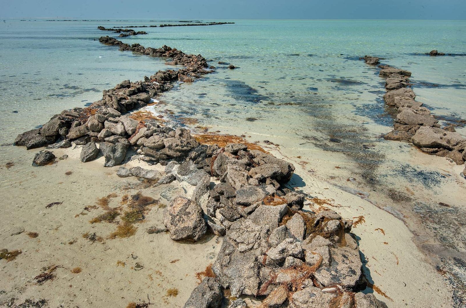
The deserted town that came before Al Zubarah: low walls, a fort and mosque footprint, and stone fish traps curving through the shallows.
Coast 3 km north of Al Zubarah, Al Shamal (north-west)
Overview
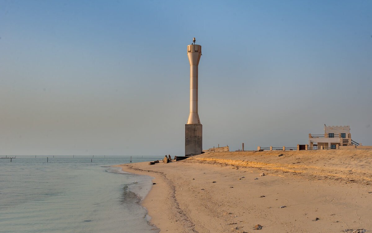
Freiha (also written Al Furayhah or Fraiha) is the site of a deserted coastal town on Qatar’s north-west shore, about 3 km north of Al Zubarah. For roughly three centuries it was a living settlement of fishermen, traders and date growers, with a small fort, a mosque and courtyard houses strung along the beach. Today it is a quiet spread of low walls, stone outlines and shell-strewn ground, with old stone fish traps still curving through the shallows offshore.
Most visitors to the north-west head straight for Al Zubarah Fort and the UNESCO-listed town beside it, and never realise that Freiha was there first. That is the reason to come. Standing among its ruins, with the sea in front and the empty plain behind, you get a sense of the older, rougher coast that Al Zubarah grew out of, without fences full of visitors or a ticket desk.
This is a site for curious, independent travellers: history readers, photographers who like texture and empty space, and anyone already doing a north-west heritage loop. There is no visitor centre, no signage to speak of and no facilities, so a little preparation goes a long way. Please read the access notes below before you set out.
History and background
Archaeologists from the Qatar Islamic Archaeology and Heritage Project, a partnership between Qatar Museums and the University of Copenhagen that began in 2009, have mapped and excavated Freiha in detail. Their work shows a late Islamic town that flourished from about the 16th to the 18th century. At its peak it may have covered almost 18 hectares, with buildings running some 1.3 km along the shore and around 400 metres inland. The best-preserved structures lie in the south; to the north and east only fragments and rubbish heaps survive, which suggests the town gradually shifted southwards over time.
Written history adds names and dates. Branches of the Bani Utbah, the tribal confederation that later produced the ruling families of Kuwait and Bahrain, are said to have settled here after migrating from central Arabia before 1700, and to have left a few decades later after tensions with neighbouring groups. In the 1760s some families returned from Kuwait to Qatar’s north-west coast, and the Al Bin Ali are recorded as resettling Freiha. In December 1783 a Persian force landed on the coast between Al Zubarah and Freiha; it was driven back by local tribes, among them the Al Maadeed of Freiha.
The excavations uncovered a small fort, Qal’at Freiha, with corner towers, excavated in 2005. Nearby stood a mosque with a courtyard, an open portico on its west side and a prayer hall. It was rebuilt in at least five phases, collapsing and being repaired again and again, a pattern repeated in the houses. Those houses were built of local stone around courtyards, with small cellular rooms. Archaeologists found grinding stones and date presses (madabis), fishing net weights and large quantities of fish bone. Fine imported ceramics, including Chinese porcelain and Persian wares, show the town was connected to wider Gulf and Indian Ocean trade and that some households were reasonably well off.
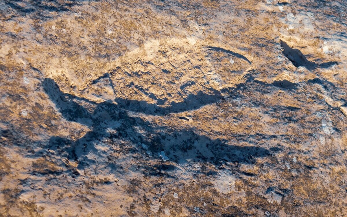
Freiha is even older in another sense. In 1956 Danish archaeologists recorded several hundred cup-marks carved into the rock near the shore, and a 1983 survey by Hans Kapel counted 303 carvings. They are similar to the better-known engravings at Al Jassasiya on the north-east coast.
Freiha was never folded into the UNESCO World Heritage property at Al Zubarah. The nomination documents describe it as part of the wider setting of Al Zubarah, outside both the inscribed area and its buffer zone. Understanding it as Al Zubarah’s older neighbour and rival is the key to the place.
What to see and do
Trace the town along the shore
The ruins are low, so the best approach is to walk parallel to the beach and let the pattern emerge. Look for straight lines of stone breaking the surface, corners where walls meet, and slight hollows that were once courtyards. The southern end holds the clearest remains. With the dimensions in mind (more than a kilometre along the coast) you begin to see how big this town once was.
Find the fort and the mosque
Qal’at Freiha and the mosque are the two buildings excavators studied most closely. What remains is modest: low walls and footprints rather than standing structures. The mosque’s orientation towards Mecca and its small courtyard can still be picked out. Don’t climb on any walls and don’t enter fenced or covered excavation areas.
Look for the stone fish traps
At low tide, long curving lines of stacked stones appear in the shallows. These are tidal fish traps: fish swim in over the walls at high water and are stranded when the tide drops. They are among the most photogenic sights on this coast and a vivid link to the town’s fishing economy. Admire them from the shore or the dry flats; they are fragile and easily disturbed.
Study the beachrock
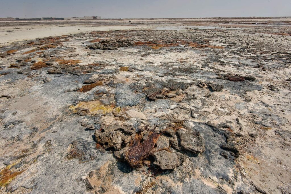
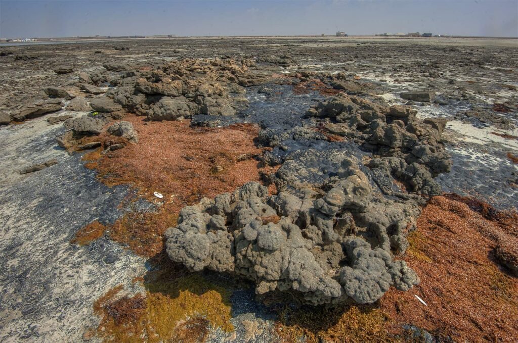
The shoreline is made of beachrock, the same material used in many of the north’s old buildings. Here it has weathered into textured plates in grey, cream and rust, often patterned with pools and channels. Some stretches are stained dark from old oil residue, a reminder of how busy the Gulf’s shipping lanes are. Wear sturdy shoes: the edges are sharp and can be slippery.
Keep an eye out for rock carvings
Surveyors have recorded hundreds of small cup-marks carved into the rock at Freiha. They are subtle and easy to miss, usually small circular hollows in groups. If you find some, photograph them without touching, chalking or wetting the rock.
Enjoy the emptiness
Part of Freiha’s value is simply how quiet it is. On a winter afternoon you may have the whole coast to yourself, with only the wind, the call of shorebirds and the outline of Al Zubarah Fort on the horizon to the south.
How to get there
From Doha, take the Al Shamal Road north for roughly 80 km, then turn west onto the road signposted for Al Zubarah. Continue to Al Zubarah Fort; Freiha lies about 3 km further north along the coast. The total distance is around 100 to 110 km, a drive of about 1 hour 15 minutes to 1 hour 30 minutes. The map pin on this page is set on the settlement area.
The final approach from the paved road is on sandy and stony tracks. A 4×4 or high-clearance SUV is the sensible choice, particularly after rain, when the low ground can turn soft. Park on firm ground away from the ruins and walk in. There is no public transport, and taxis are not practical for a trip this far. Some tour companies offer north-west heritage day trips by 4×4 that focus on Al Zubarah; ask in advance whether Freiha can be added.
Best time to visit
November to March is the most pleasant time, when temperatures are moderate and the light is soft. Avoid the hot months from May to September; the site is completely exposed and there is no help nearby if your car gets stuck.
Time your visit for low tide if you want to see the fish traps clearly; check a tide table for the north-west coast before you go. Late afternoon is ideal for photographs, when the low sun picks out the lines of the walls and the sea turns silver. Combining Freiha with Al Zubarah Fort during its opening hours makes a natural half-day.
Tips for your visit
- Check access first. Freiha is an archaeological site under Qatar Museums. The national monuments list advises contacting Qatar Museums before visiting. If parts are fenced or signed as closed, view them from outside.
- Don’t drive onto the ruins. Many walls are barely above ground level. Stick to existing tracks and park well away.
- Take nothing. Pottery fragments, shells and stones are part of the archaeological record. Removing them is prohibited.
- Read up beforehand. With no on-site interpretation, knowing the story makes all the difference.
- Bring all supplies. There are no shops, toilets or shade. The nearest small services are in Madinat ash Shamal and Al Ruwais.
- Wear proper shoes. Beachrock is sharp and the ground is uneven.
- Tell someone your plan. Phone signal can be patchy on the remote north-west coast.
What to bring
- Plenty of water and snacks
- Sun hat, sunglasses and sunscreen
- Sturdy closed shoes
- A tide table and an offline map
- Basic recovery kit (tyre gauge, shovel, tow strap) if driving on sand
- Binoculars for shorebirds
Combine it with nearby places
Al Zubarah Fort and Archaeological Site. Qatar’s UNESCO World Heritage Site, with a restored 1938 fort, a museum and the excavated remains of a major 18th-century pearling and trading town, just to the south.
Al Rakiyat Fort. A restored desert fort a short drive inland, with clean lines and corner towers that show what Qal’at Freiha may once have looked like.
Al Thaqab Fort. Another small restored fort in the north-west interior, often visited on the same loop.
Al Arish Abandoned Village. A 20th-century fishing village further up the coast, with a striking minaret and an old police station.
Al Jumail Abandoned Village. One of the north’s most atmospheric deserted villages, closer to Al Ruwais.
Frequently asked questions
What is Freiha?
Freiha is a deserted late Islamic town on Qatar’s north-west coast, occupied mainly from the 16th to the 18th century. Its remains include a small fort, a mosque, courtyard houses and tidal fish traps.
Is Freiha part of the Al Zubarah World Heritage Site?
No. UNESCO’s documents describe Freiha as part of Al Zubarah’s wider setting, outside the inscribed property and its buffer zone.
Can you visit Freiha?
Freiha is an archaeological site managed under Qatar Museums. There are no visitor facilities, and the national monuments list advises contacting Qatar Museums before visiting. Respect any fences or signs.
Do I need a 4×4?
The last section is on sandy and stony tracks, so a 4×4 or high-clearance vehicle is strongly recommended.
How far is Freiha from Al Zubarah?
About 3 km north, a few minutes’ drive along the coast.
Is there an entry fee?
No fee is listed for Freiha. Al Zubarah Fort nearby has its own opening hours, so check them with Qatar Museums.
Last checked October 2026. Hours, fees and access can change, so confirm with the official source before you go.
More places nearby
All places → Beaches & IslandsAbu Dhalouf Park and Bahar Mosque, Al ShamalAl Shamal & Zubarah
 Beaches & IslandsAl Ghariya Beach, Al ShamalAl Shamal & Zubarah
 Heritage & FortsAl Jassasiya Rock Carvings, Al ShamalAl Shamal & Zubarah
Run a tour, café or stay near Freiha Archaeological Site, Al Shamal?
List your business free on Companies in Qatar, or get featured on Qatar Unseen in front of people planning their trip.